Climatology modelled -- Global wind map
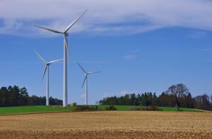
Using an accurate, consistent and comprehensive dataset of global wind resources, American renewables assessment and forecasting firm 3Tier has produced a global wind map at a resolution of five kilometres. For any location in the world, "This map and dataset shortens the process needed to make sound decisions about where to invest in wind energy generation," says company founder Kenneth Westrick. Many traditional forecasting models interpolate observed wind speeds between widely dispersed points, but 3Tier's system integrates statistical methods with the power of physical-based models, which simulate the interaction between the atmosphere and the earth's surface, to create a more robust and accurate wind climatology. That means the myriad processes responsible for wind -- from jet level dynamics to surface level processes -- are accounted for in these models. They can create realistic wind fields throughout the world, with the results especially useful in regions where observations are not available. The model was run through a ten year simulation across the world's landmass at a five kilometre resolution and 3Tier calibrated and validated the results with observational data to create the final dataset and, ultimately, the world map. The interactive map will be available on the company's web site for free and can be used to provide wind speed in meters per second anywhere in the world.
.png)


.png)