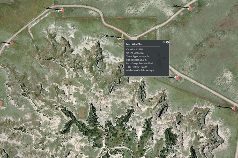
, which covers more than 47,000 onshore turbine locations, was launched by governmental scientific agency the US Geological Survey.
Users can zoom in on specific wind developments and obtain information such as turbine capacity, blade length and tower type.
"In addition to informing siting decisions for future wind energy projects, this fundamental, nationwide data will support research on wind generation efficiency, economic impacts and applied science for reducing wildlife impacts," said assistant secretary for water and science Anne Castle.
Turbines installed as of July 2013 are currently included in the data set.
It was compiled from publicly available data from the Federal Aviation Administration, the US Energy Information Administration, the Oak Ridge National Laboratory, as well as other federal, state and local sources.
The location of each turbine has been verified to within plus or minus 10 metres. The resolution of the satellite image is so high that each turbine can be clearly seen on the map.
.png)


.png)